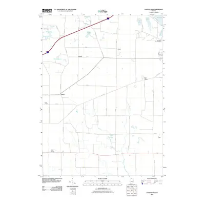
2010 Map of LaPorte West
USGS Topo · Published 2010About this map
La Porte’s western suburban and rural fringes are defined here by a transition from industrial and recreational lakeside developments to a structured agricultural grid. The city's edge is marked by the Laporte Fair Grounds and a cluster of water bodies including Pine Lake, Stone Lake, and Orr Lake. A network of rural settlements such as Durham, Pinola, and Pinhook dot the landscape, connected by a dense lattice of numbered roads like S Wozniak Rd and the diagonal sweep of the Indiana Toll Rd. This layout reflects the area's mid-century development as it balanced its role as a regional hub with its agricultural foundations. Notable for genealogists are several historic burial sites, including Eaheart Cemetery and Clinton Chapel Cemetery, while the presence of the Walton Lake Dam and Mill Creek illustrates the local management of the region's abundant glacial water resources.
Find a feature on this map
47 named features on this map. Tap any name to fly to it.
Don’t see what you’re looking for? This feature index may not catch every label — zoom into the map to look around manually.
Map Details
Editions of this 2010 LaPorte West Map
This is the sole edition of this map. No revisions or reprints were ever made.
Other maps of this area

1953 · Wanatah
USGS Topo · 1:24,000

1953 · Westville
USGS Topo · 1:24,000

1953 · Michigan City West
USGS Topo · 1:24,000

1953 · Chicago
USGS Topo · 1:250,000

1957 · Chicago
USGS Topo · 1:250,000

1958 · Hanna
USGS Topo · 1:24,000

1958 · Kingsford Heights
USGS Topo · 1:24,000

1958 · Michigan City East
USGS Topo · 1:24,000

1958 · La Porte East
USGS Topo · 1:24,000

1958 · Springville
USGS Topo · 1:24,000