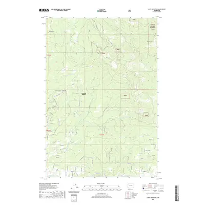
2020 Map of Larch Mountain
USGS Topo · Published 2020About this map
Creswell Heights and the small settlement of Ireland are prominent residential and agricultural nodes in this section of Clark County, where the landscape transitions into the southern reaches of the Gifford Pinchot National Forest. The topography is defined by significant elevations such as Larch Mtn, Livingston Mtn, and Elkhorn Mtn, with the Washougal River and Little Washougal River carving through the valleys. The map documents a complex network of forest access and recreational paths including Murphy's Grade, Cold Creek Trail, and the Cold Creek Loop. Geologic landmarks like Pyramid Rock and transit points like Jackson Pass mark the higher ground, while lower elevations near the southern border feature Washougal Lake and Carnelian Cr. The layout of roads like NE Ireland Rd and NE Stauffer Rd reflects the long-standing rural development pattern of the region before entering the protected forest lands.
Find a feature on this map
93 named features on this map. Tap any name to fly to it.
Don’t see what you’re looking for? This feature index may not catch every label — zoom into the map to look around manually.
Map Details
Editions of this 2020 Larch Mountain Map
This is the sole edition of this map. No revisions or reprints were ever made.
Other maps of this area

1918 · Troutdale
USGS Topo · 1:62,500

1934 · Troutdale
USGS Topo · 1:48,000

1940 · Lookout Mtn
USGS Topo · 1:62,500

1941 · Yacolt
USGS Topo · 1:62,500

1941 · Camas
USGS Topo · 1:62,500

1942 · Camas
USGS Topo · 1:62,500

1948 · Vancouver
USGS Topo · 1:250,000

1950 · Vancouver
USGS Topo · 1:250,000

1950 · Vancouver
USGS Topo · 1:250,000

1953 · Lookout Mtn
USGS Topo · 1:62,500