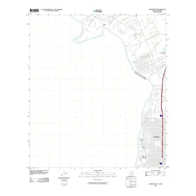
2010 Map of Laredo West
USGS Topo · Published 2010About this map
Fort McIntosh stands as a prominent landmark on the northern bank of the Rio Grande, marking a site of long-standing military and historical significance at the edge of Laredo. This borderland landscape is defined by the sharp transition from the dense urban grid of Laredo to the developing suburban tracts and ranch lands to the west. The influence of the river is central to the area's layout, with the international boundary between the United States and Mexico following its winding course.
Find a feature on this map
22 named features on this map. Tap any name to fly to it.
Don’t see what you’re looking for? This feature index may not catch every label — zoom into the map to look around manually.
Map Details
Editions of this 2010 Laredo West Map
This is the sole edition of this map. No revisions or reprints were ever made.
Other maps of this area

1933 · Becerra Creek
USGS Topo · 1:62,500

1956 · Islitas
USGS Topo · 1:62,500

1956 · Laredo East
USGS Topo · 1:62,500

1956 · Laredo
USGS Topo · 1:250,000

1965 · Laredo West
USGS Topo · 1:24,000

1965 · Orvil
USGS Topo · 1:24,000

1965 · Cuervo Creek
USGS Topo · 1:24,000
1965 · Dolores Ranch
USGS Topo · 1:24,000

1965 · Laredo East
USGS Topo · 1:24,000

1979 · Laredo South
USGS Topo · 1:24,000