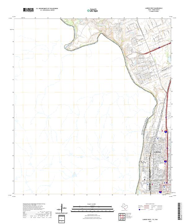
2022 Map of Laredo West
USGS Topo · Published 2022About this map
The Rio Grande serves as the international boundary on this modern survey of the Texas-Mexico border, winding past the western edge of Laredo. The landscape transition is stark, moving from the dense street grids and institutional hubs of the city to the brush-carved drainages of Sombrerito Cr and the heights of El Pico. This edition highlights the historic grounds of the Laredo Community College Fort McIntosh Campus, where the Fort McIntosh Cem stands as a link to the city's 19th-century military origins. Further north, the shift toward industrial development is evident along Killam Industrial Blvd and the arterial Bob Bullock Loop, while labels like Old Mines Rd offer a nomenclatural nod to the region's earlier extractive history near La Presa Azul.
Find a feature on this map
91 named features on this map. Tap any name to fly to it.
Don’t see what you’re looking for? This feature index may not catch every label — zoom into the map to look around manually.
Map Details
Editions of this 2022 Laredo West Map
This is the sole edition of this map. No revisions or reprints were ever made.
Other maps of this area

1933 · Becerra Creek
USGS Topo · 1:62,500

1956 · Islitas
USGS Topo · 1:62,500

1956 · Laredo East
USGS Topo · 1:62,500

1956 · Laredo
USGS Topo · 1:250,000

1965 · Laredo West
USGS Topo · 1:24,000

1965 · Orvil
USGS Topo · 1:24,000

1965 · Cuervo Creek
USGS Topo · 1:24,000
1965 · Dolores Ranch
USGS Topo · 1:24,000

1965 · Laredo East
USGS Topo · 1:24,000

1979 · Laredo South
USGS Topo · 1:24,000