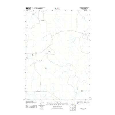
2012 Map of Larey Draw
USGS Topo · Published 2012About this map
Spotted Horse Creek and its many seasonal tributaries carve a complex drainage system across this Campbell County landscape. The area is defined by its numerous topographic depressions known as draws, including the eponymous Larey Draw, Carter Draw, and the curiously named Dead Calf Draw. Water management in this arid environment is evident through several small impoundments such as Okeson Reservoir and Fitzgerald Reservoir, which serve as vital collection points for intermittent flow from features like North Fork Okeson Draw. The network of rural routes, including Ivy Creek Road and Barton Road, provides access to this vast rangeland where drainage patterns like the North Prong Wild Horse Creek and Middle Prong Wild Horse Creek dictate the movement of both livestock and machinery.
Find a feature on this map
21 named features on this map. Tap any name to fly to it.
Don’t see what you’re looking for? This feature index may not catch every label — zoom into the map to look around manually.
Map Details
Editions of this 2012 Larey Draw Map
This is the sole edition of this map. No revisions or reprints were ever made.
Other maps of this area

1954 · Gillette
USGS Topo · 1:250,000

1955 · Sheridan
USGS Topo · 1:250,000

1955 · Gillette
USGS Topo · 1:250,000

1958 · Gillette
USGS Topo · 1:250,000

1958 · Sheridan
USGS Topo · 1:250,000

1962 · Gillette
USGS Topo · 1:250,000

1962 · Sheridan
USGS Topo · 1:250,000

1971 · Larey Draw
USGS Topo · 1:24,000
1971 · Reservoir Creek
USGS Topo · 1:24,000

1971 · Cabin Creek SE
USGS Topo · 1:24,000