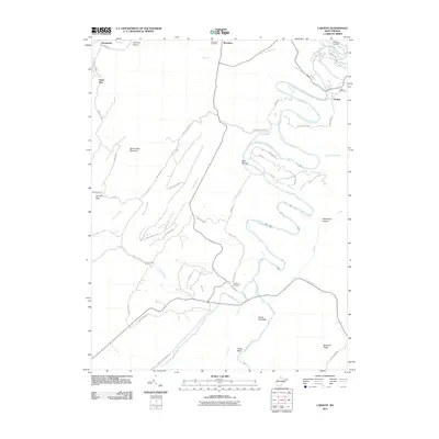
2011 Map of Largent
USGS Topo · Published 2011About this map
The Cacapon River winds in deep oxbow loops through this portion of Hampshire County, defining a landscape of narrow hollows and steep ridges. This 2011 survey details the rural character of the region, where settlements like Largent and Woodrow are connected by a network of winding roads such as Owl Hollow Rd and Cabin Run Rd. The convergence of waterways is a focal point for local geography, specifically at the Forks of Cacapon where the North River meets the main stem.
Find a feature on this map
61 named features on this map. Tap any name to fly to it.
Don’t see what you’re looking for? This feature index may not catch every label — zoom into the map to look around manually.
Map Details
Editions of this 2011 Largent Map
This is the sole edition of this map. No revisions or reprints were ever made.
Other maps of this area

1891 · Romney
USGS Topo · 1:125,000

1894 · Winchester
USGS Topo · 1:125,000

1898 · Paw Paw
USGS Topo · 1:62,500

1899 · Flintstone
USGS Topo · 1:62,500

1900 · Pawpaw
USGS Topo · 1:62,500

1900 · Flintstone
USGS Topo · 1:62,500

1910 · Paw Paw
USGS Topo · 1:62,500

1916 · Capon Bridge
USGS Topo · 1:62,500

1921 · Hanging Rock
USGS Topo · 1:48,000

1923 · Capon Bridge
USGS Topo · 1:62,500