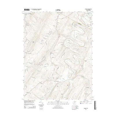
2014 Map of Largent
USGS Topo · Published 2014About this map
The Cacapon River carves deep, sinuous meanders through this portion of the Appalachian Mountains, creating a dramatic landscape of high ridges and narrow valleys. This 2014 survey documents the enduring rural character of northeastern West Virginia, where the river serves as the primary corridor for small settlements like Woodrow and Largent. The rugged terrain is defined by prominent features such as Spring Gap Mtn and Sideling Hill, which force the road network into winding paths. For local historians, the map preserves the location of many isolated burial grounds and community focal points, including the Old Bethel Cem and the Island Hill Cem. The southern reach of the sheet follows the Bloomery Pike toward the community of Bloomery, tracing the confluence where the North River meets the Cacapon, a site historically significant for its water access and proximity to Castle Rock.
Find a feature on this map
118 named features on this map. Tap any name to fly to it.
Don’t see what you’re looking for? This feature index may not catch every label — zoom into the map to look around manually.
Map Details
Editions of this 2014 Largent Map
This is the sole edition of this map. No revisions or reprints were ever made.
Other maps of this area

1891 · Romney
USGS Topo · 1:125,000

1894 · Winchester
USGS Topo · 1:125,000

1898 · Paw Paw
USGS Topo · 1:62,500

1899 · Flintstone
USGS Topo · 1:62,500

1900 · Pawpaw
USGS Topo · 1:62,500

1900 · Flintstone
USGS Topo · 1:62,500

1910 · Paw Paw
USGS Topo · 1:62,500

1916 · Capon Bridge
USGS Topo · 1:62,500

1921 · Hanging Rock
USGS Topo · 1:48,000

1923 · Capon Bridge
USGS Topo · 1:62,500