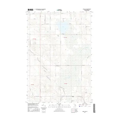
2017 Map of Larks Lake
USGS Topo · Published 2017About this map
Larks Lake and its surrounding wetlands define the landscape of northern Emmet County in this 2017 survey. The area is characterized by an extensive network of footpaths, including the N Country National Scenic Trail and the Iron Belle Trail, which wind through the forested terrain and past landmarks like Mt Pisage. The settlement of Pleasant View sits in the southeastern portion of the map, served by a cluster of local cemeteries that offer significant value for genealogical research, including Pleasant View Cem, Starr Cem, and Saint Nichols Cem.
Find a feature on this map
50 named features on this map. Tap any name to fly to it.
Don’t see what you’re looking for? This feature index may not catch every label — zoom into the map to look around manually.
Map Details
Editions of this 2017 Larks Lake Map
This is the sole edition of this map. No revisions or reprints were ever made.
Other maps of this area

1955 · Cheboygan
USGS Topo · 1:250,000

1958 · Cheboygan
USGS Topo · 1:250,000

1958 · Cross Village
USGS Topo · 1:62,500

1958 · Pellston
USGS Topo · 1:62,500

1958 · Bayshore
USGS Topo · 1:62,500

1958 · Petoskey
USGS Topo · 1:62,500

1975 · Petoskey NW
USGS Topo · 1:24,000

1975 · Petoskey NE
USGS Topo · 1:24,000

1982 · Petoskey
USGS Topo · 1:100,000
1982 · Levering
USGS Topo · 1:25,000
Featured Places
- Pleasantview Township, MI
- Marsh Corner, MI
- Pleasantview, MI
- Cross Village Township, MI
- Friendship Township, MI