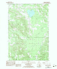
1982 Map of Larks Lake
USGS Topo · Published 1983About this map
Mackinaw State Forest covers a significant portion of this terrain in northern Emmet County, where the landscape is defined by the expansive Larks Lake and its surrounding Larks Lake Swamp. The map details a rural network of townships including Readmond, Center, Friendship, and Pleasant View. Settlement patterns are concentrated at small junctions such as Maple Tree Corners, Marsh Corner, and the northern edge of Cross Village.
Find a feature on this map
44 named features on this map. Tap any name to fly to it.
Don’t see what you’re looking for? This feature index may not catch every label — zoom into the map to look around manually.
Map Details
Editions of this 1982 Larks Lake Map
This is the sole edition of this map. No revisions or reprints were ever made.
Other maps of this area

1955 · Cheboygan
USGS Topo · 1:250,000

1958 · Cheboygan
USGS Topo · 1:250,000

1958 · Cross Village
USGS Topo · 1:62,500

1958 · Pellston
USGS Topo · 1:62,500

1958 · Bayshore
USGS Topo · 1:62,500

1958 · Petoskey
USGS Topo · 1:62,500

1975 · Petoskey NW
USGS Topo · 1:24,000

1975 · Petoskey NE
USGS Topo · 1:24,000

1982 · Petoskey
USGS Topo · 1:100,000
1982 · Levering
USGS Topo · 1:25,000
Featured Places
- Pleasantview Township, MI
- Friendship Township, MI
- Pleasantview, MI
- Readmond Township, MI
- Cross Village Township, MI