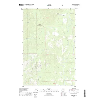
2020 Map of Larsen Creek
USGS Topo · Published 2020About this map
Olympic National Forest occupies a significant portion of this terrain, where the headwaters of the Wishkah River and Wynoochee River carve through the landscape. The map highlights the critical infrastructure of the Aberdeen Watershed, including Aberdeen Reservoir and Wishkah Reservoir Number Two, illustrating how the region's abundant rainfall and drainage basins are managed for municipal water. High points such as Fitzgerald Peak, Olympic Mountain, and Cougar Mtn define the topography, which is etched with a network of forest roads and an Intermittent Logging Rd. These transport routes, including the Donkey Crk/Grisdale and Wynoochee Valley Road FH 203, show a land primarily dedicated to resource management and watershed protection. The winding course of the E Fork Humptulips River and features like Weatherwax Basin reflect the complex hydrology of Grays Harbor County.
Find a feature on this map
33 named features on this map. Tap any name to fly to it.
Don’t see what you’re looking for? This feature index may not catch every label — zoom into the map to look around manually.
Map Details
Editions of this 2020 Larsen Creek Map
This is the sole edition of this map. No revisions or reprints were ever made.
Other maps of this area

1921 · Quinault Lake
USGS Topo · 1:62,500

1921 · Satsop
USGS Topo · 1:62,500

1941 · Mobray
USGS Topo · 1:62,500

1943 · Humptulips
USGS Topo · 1:62,500

1943 · Mobray
USGS Topo · 1:62,500

1955 · Wynoochee Valley
USGS Topo · 1:62,500

1955 · Grisdale
USGS Topo · 1:62,500

1955 · Humptulips
USGS Topo · 1:62,500

1955 · Quinault Lake
USGS Topo · 1:62,500

1958 · Seattle
USGS Topo · 1:250,000