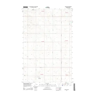
2014 Map of Larslan NW
USGS Topo · Published 2014About this map
The East Fork Snow Coulee and the broader drainage of Snow Coulee define this high-plains landscape in the Frazer District of Valley County. This 2014 survey captures a rural landscape organized by the Public Land Survey System, where modern infrastructure follows long-established section lines. The presence of School Rd suggests the historical location of rural education centers, while a network of named county roads like Baylor Rd, Tarum Rd, and Crandell Rd connect remote homesteads and agricultural tracts. This map is particularly useful for researchers tracing family landholdings across sections like T34N R42E, showing how the drainage of Hell Cr and other ephemeral waters influenced the placement of local transit routes such as Sunnyside Rd and Alden Rd in the northeastern corner of the state.
Find a feature on this map
21 named features on this map. Tap any name to fly to it.
Don’t see what you’re looking for? This feature index may not catch every label — zoom into the map to look around manually.
Map Details
Editions of this 2014 Larslan NW Map
This is the sole edition of this map. No revisions or reprints were ever made.
Other maps of this area

1954 · Glasgow
USGS Topo · 1:250,000

1957 · Glasgow
USGS Topo · 1:250,000

1958 · Glasgow
USGS Topo · 1:250,000

1973 · Baylor SE
USGS Topo · 1:24,000

1973 · Larslan
USGS Topo · 1:24,000

1973 · Glentana West
USGS Topo · 1:24,000

1973 · Larslan NW
USGS Topo · 1:24,000

1973 · Baylor NE
USGS Topo · 1:24,000

1973 · Johnnys Hill
USGS Topo · 1:24,000

1973 · Richland
USGS Topo · 1:24,000