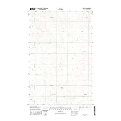
2017 Map of Larslan NW
USGS Topo · Published 2017About this map
Snow Coulee and its eastern tributary, the East Fork Snow Coulee, define the southern drainage of this Valley County landscape. The area is marked by a rigorous section-line road network typical of the Montana plains, providing access across the high prairie. Major transit routes such as the Glentana-Nashua Rd and Baylor Rd intersect at regular intervals, connecting isolated homesteads and ranching operations. In the northeast, the terrain slopes toward the headwaters of Hell Cr. The presence of numerous named roads, including Zemliska Rd, Tarum Rd, and Larslan Rd, suggests a distributed rural population tied to the expansive agricultural lands of T33N through T35N. The map illustrates the careful division of the Frazer District into township and range blocks, highlighting the intersection of natural drainage features with human-imposed surveying lines.
Find a feature on this map
21 named features on this map. Tap any name to fly to it.
Don’t see what you’re looking for? This feature index may not catch every label — zoom into the map to look around manually.
Map Details
Editions of this 2017 Larslan NW Map
This is the sole edition of this map. No revisions or reprints were ever made.
Other maps of this area

1954 · Glasgow
USGS Topo · 1:250,000

1957 · Glasgow
USGS Topo · 1:250,000

1958 · Glasgow
USGS Topo · 1:250,000

1973 · Baylor SE
USGS Topo · 1:24,000

1973 · Larslan
USGS Topo · 1:24,000

1973 · Glentana West
USGS Topo · 1:24,000

1973 · Larslan NW
USGS Topo · 1:24,000

1973 · Baylor NE
USGS Topo · 1:24,000

1973 · Johnnys Hill
USGS Topo · 1:24,000

1973 · Richland
USGS Topo · 1:24,000