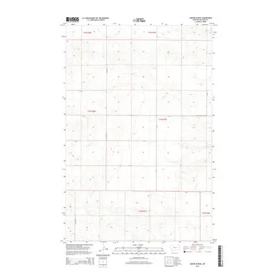
2014 Map of Larson School
USGS Topo · Published 2014About this map
Larson School-(Historical) serves as the primary historical landmark in this section of eastern Montana, signifying the rural educational heritage of Richland County. The landscape is defined by the drainage of Fox Cr, which meanders through the northern townships. The area is organized by a strictly defined grid of the Public Land Survey System, with boundaries such as t22n r57e and t21n r56e partitioning the high plains. A network of county roads, including CO Road 336 and CR-115, provides the only modern infrastructure through these undulating draws and ridges. The presence of the historical school site indicates a former community hub in what is now a predominantly agricultural and open rangeland setting, offering a clear record of the region's human geography before later consolidation.
Find a feature on this map
17 named features on this map. Tap any name to fly to it.
Don’t see what you’re looking for? This feature index may not catch every label — zoom into the map to look around manually.
Map Details
Editions of this 2014 Larson School Map
This is the sole edition of this map. No revisions or reprints were ever made.
Other maps of this area

1909 · Glendive
USGS Topo · 1:250,000

1954 · Glendive
USGS Topo · 1:250,000

1957 · Glendive
USGS Topo · 1:250,000

1958 · Glendive
USGS Topo · 1:250,000

1966 · Savage
USGS Topo · 1:24,000

1966 · Crane NE
USGS Topo · 1:24,000

1966 · Crane NW
USGS Topo · 1:24,000

1966 · Knife River Mine
USGS Topo · 1:24,000

1966 · Crane
USGS Topo · 1:24,000

1966 · Allard Ranch
USGS Topo · 1:24,000