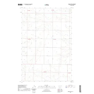
2020 Map of Larson School
USGS Topo · Published 2020About this map
Larson School serves as a lone institutional anchor in this rural portion of Richland County, situated near the intersection of Co Rd 115 and Co Rd 340. The landscape is defined by the drainage patterns of several seasonal watercourses, including Fox Cr in the north and the meandering paths of Crane Cr and Sears Cr further south. These creek beds dictate the subtle topography of the region, which is primarily organized by the Public Land Survey System into townships like t21n r57e and t22n r57e. The road network follows a strict rectilinear grid of county routes, such as Co Rd 114 and Co Rd 113, reflecting the systematic division of agricultural or grazing land. This map illustrates the intersection of natural drainage and human-imposed boundaries in the high plains of eastern Montana.
Find a feature on this map
20 named features on this map. Tap any name to fly to it.
Don’t see what you’re looking for? This feature index may not catch every label — zoom into the map to look around manually.
Map Details
Editions of this 2020 Larson School Map
This is the sole edition of this map. No revisions or reprints were ever made.
Other maps of this area

1909 · Glendive
USGS Topo · 1:250,000

1954 · Glendive
USGS Topo · 1:250,000

1957 · Glendive
USGS Topo · 1:250,000

1958 · Glendive
USGS Topo · 1:250,000

1966 · Savage
USGS Topo · 1:24,000

1966 · Crane NE
USGS Topo · 1:24,000

1966 · Crane NW
USGS Topo · 1:24,000

1966 · Knife River Mine
USGS Topo · 1:24,000

1966 · Crane
USGS Topo · 1:24,000

1966 · Allard Ranch
USGS Topo · 1:24,000