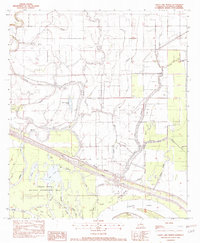
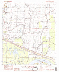
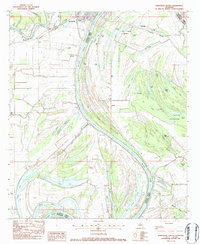
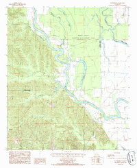
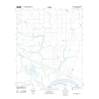
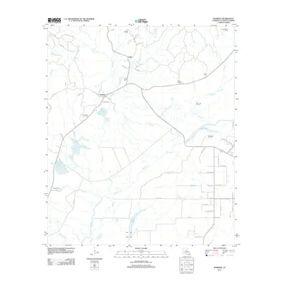
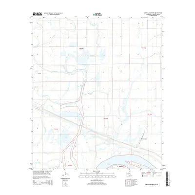
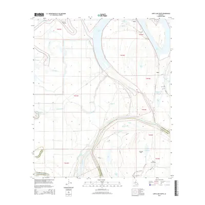
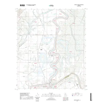
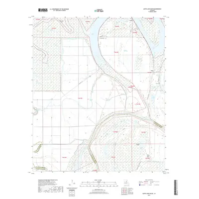
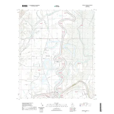
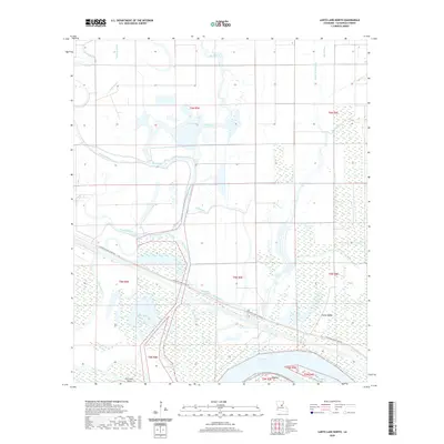
1982 Map of Larto Lake North
USGS Topo · Published 1982About this map
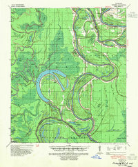
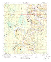
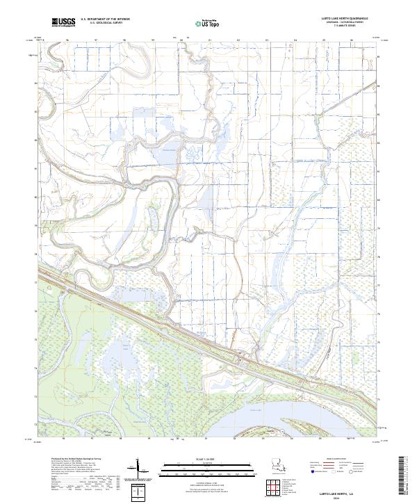
The Saline State Wildlife Management Area anchors the southern portion of this 1982 survey, illustrating the complex hydrology of the Catahoula Parish bottomlands. The landscape is defined by an intricate network of water bodies, including Larto Lake, Maknockanut Lake, and Honey Brake Lake, all connected by a web of bayous such as Big Bayou and Cypress Bayou. A significant engineering feature, the Diversion Canal, cuts across the terrain to manage water flow between these systems. Industrial and agricultural activity is evident through the Big Bayou Oil Field and the Louisiana Delta Plantation Landing Strip, which serve as markers of the local economy during the early 1980s. The presence of Foster Ridge provides a rare point of elevation in a region otherwise dominated by wetlands and drainage features like Honey Brake Bayou and Larto Slough.
Find a feature on this map
33 named features on this map. Tap any name to fly to it.
Don’t see what you’re looking for? This feature index may not catch every label — zoom into the map to look around manually.
Map Details
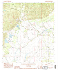
Editions of this 1982 Larto Lake North Map
2 editions found
Historical Maps of Catahoula Parish Through Time
60 maps found

1935 Tooleys
Catahoula Parish, LA

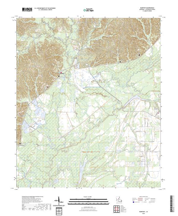
1941 Manifest
Catahoula Parish, LA
1941 Tooleys
Catahoula Parish, LA
1960 Eva
Catahoula Parish, LA
1976 Sicily Island SW
Catahoula Parish, LA
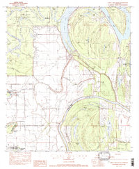
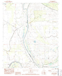
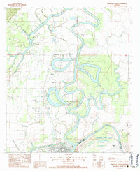
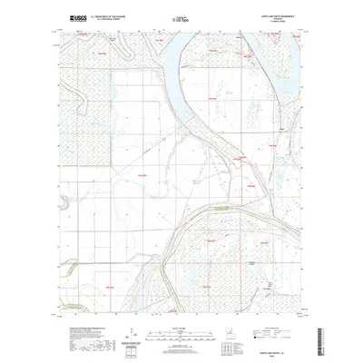
1982 Larto Lake North
Catahoula Parish, LA
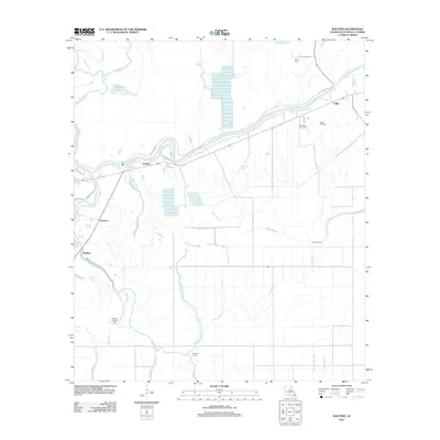
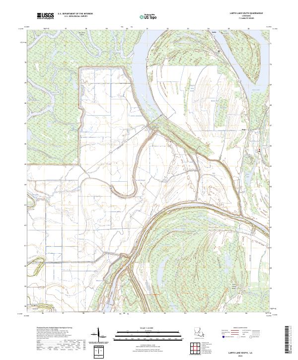
1982 Larto Lake South
Catahoula Parish, LA
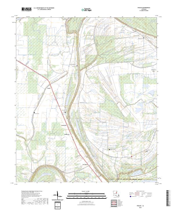
1983 Foules
Catahoula Parish, LA
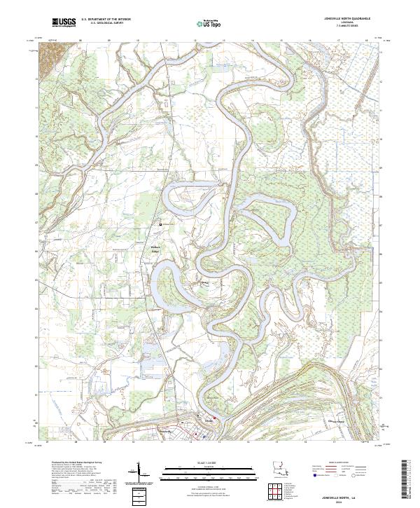
1983 Jonesville North
Catahoula Parish, LA
1983 Jonesville South
Catahoula Parish, LA
1983 Manifest
Catahoula Parish, LA
1983 Walters
Catahoula Parish, LA
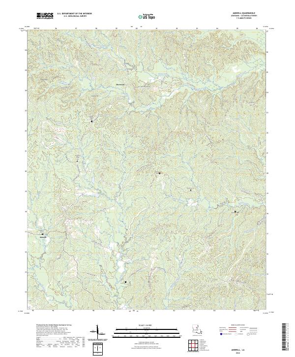
1984 Aimwell
Catahoula Parish, LA
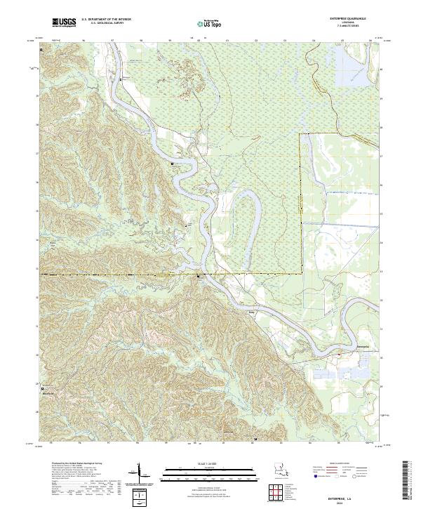
1984 Enterprise
Catahoula Parish, LA
1995 Walters
Catahoula Parish, LA
2012 Aimwell
Catahoula Parish, LA
2012 Enterprise
Catahoula Parish, LA
2012 Foules
Catahoula Parish, LA

2012 Jonesville North
Catahoula Parish, LA
2012 Jonesville South
Catahoula Parish, LA
2012 Larto Lake North
Catahoula Parish, LA
2012 Larto Lake South
Catahoula Parish, LA
2012 Manifest
Catahoula Parish, LA
2012 Walters
Catahoula Parish, LA
2015 Aimwell
Catahoula Parish, LA
2015 Enterprise
Catahoula Parish, LA
2015 Foules
Catahoula Parish, LA
2015 Jonesville North
Catahoula Parish, LA
2015 Jonesville South
Catahoula Parish, LA
2015 Larto Lake North
Catahoula Parish, LA
2015 Larto Lake South
Catahoula Parish, LA
2015 Manifest
Catahoula Parish, LA
2015 Walters
Catahoula Parish, LA
2018 Aimwell
Catahoula Parish, LA

2018 Enterprise
Catahoula Parish, LA
2018 Foules
Catahoula Parish, LA
2018 Jonesville North
Catahoula Parish, LA
2018 Jonesville South
Catahoula Parish, LA
2018 Larto Lake North
Catahoula Parish, LA
2018 Larto Lake South
Catahoula Parish, LA
2018 Manifest
Catahoula Parish, LA
2018 Walters
Catahoula Parish, LA
2020 Aimwell
Catahoula Parish, LA
2020 Enterprise
Catahoula Parish, LA
2020 Foules
Catahoula Parish, LA
2020 Jonesville North
Catahoula Parish, LA
2020 Jonesville South
Catahoula Parish, LA
2020 Larto Lake North
Catahoula Parish, LA
2020 Larto Lake South
Catahoula Parish, LA
2020 Manifest
Catahoula Parish, LA
2020 Walters
Catahoula Parish, LA
2024 Aimwell
Catahoula Parish, LA
2024 Enterprise
Catahoula Parish, LA
2024 Foules
Catahoula Parish, LA
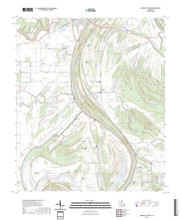
2024 Jonesville North
Catahoula Parish, LA
2024 Jonesville South
Catahoula Parish, LA
2024 Larto Lake North
Catahoula Parish, LA
2024 Larto Lake South
Catahoula Parish, LA
2024 Manifest
Catahoula Parish, LA
2024 Walters
Catahoula Parish, LA