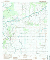
1983 Map of Walters
USGS Topo · Published 1984About this map
The Little River and its intricate network of bayous and brakes dominate this Catahoula Parish landscape, reflecting the watery geography of the Louisiana delta in the late 1970s and early 1980s. Small rural communities like Utility, Archie, Lavacca, and Walters are connected by Louisiana 8 and the Midland railroad corridor. The map provides significant genealogical value through its documentation of rural religious life, featuring the Evergreen Ch, New Mt Olive Ch, and Old Mt Olive Ch, along with the Old Mt Olive Cem and Young Cem.
Find a feature on this map
42 named features on this map. Tap any name to fly to it.
Don’t see what you’re looking for? This feature index may not catch every label — zoom into the map to look around manually.
Map Details
Editions of this 1983 Walters Map
This is the sole edition of this map. No revisions or reprints were ever made.
Other maps of this area

1935 · Tooleys
USGS Topo · 1:62,500

1941 · Manifest
USGS Topo · 1:62,500

1941 · Jena
USGS Topo · 1:62,500

1941 · Buckeye
USGS Topo · 1:62,500

1941 · Tooleys
USGS Topo · 1:62,500

1953 · Alexandria
USGS Topo · 1:250,000

1953 · Natchez
USGS Topo · 1:250,000

1955 · Alexandria
USGS Topo · 1:250,000

1956 · Natchez
USGS Topo · 1:250,000

1958 · Jena
USGS Topo · 1:62,500