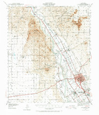
1941 Map of Las Cruces
USGS Topo · Published 1965About this map
The Rio Grande valley in Southern New Mexico anchors this 1941 landscape, where the intricate network of the Leasburg Canal and Mesilla Drain supports a flourishing agricultural corridor. The city of Las Cruces appears as the primary hub, while historic settlements like Mesilla and Dona Ana maintain their traditional layouts. Significant landmarks of education and faith, such as the New Mexico State College and Loretto Academy, are clearly mapped alongside the Atchison Topeka and Santa Fe railroad, which parallels the river.
Find a feature on this map
64 named features on this map. Tap any name to fly to it.
Don’t see what you’re looking for? This feature index may not catch every label — zoom into the map to look around manually.
Map Details
Editions of this 1941 Las Cruces Map
2 editions found
Other maps of this area

1891 · Las Cruces
USGS Topo · 1:125,000

1893 · Las Cruces
USGS Topo · 1:125,000

1916 · Tonuco
USGS Topo · 1:125,000

1932 · Tonuco
USGS Topo · 1:125,000

1941 · Las Cruces
USGS Topo · 1:62,500

1941 · Organ Peak
USGS Topo · 1:62,500

1941 · Aden
USGS Topo · 1:62,500

1943 · La Mesa
USGS Topo · 1:62,500

1943 · Aden
USGS Topo · 1:62,500

1943 · Organ Peak
USGS Topo · 1:62,500