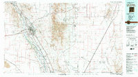
1982 Map of Las Cruces
USGS Topo · Published 1982About this map
The Rio Grande valley serves as the central artery for this high-desert landscape, where the fertile floodplains of the Mesilla Civil Colony Tract No 1 and Brazito Grant contrast sharply with the surrounding arid peaks. Historically significant landmarks such as Fort Selden State Monument and the church of Santo Tomas anchor the region's heritage, while the sprawling campus of New Mexico State University marks its mid-century growth. To the east, the dramatic silhouette of the Organ Mountains separates the valley from the high-security operations of the White Sands Missile Range and the White Sands Test Facility (NASA). The presence of numerous mining operations like the Silver King Mine and Black Prince Mine in the foothills, alongside the corridor of the Atchison Topeka and Santa Fe railroad, illustrates the enduring relationship between mineral extraction and transportation in the Southwest.
Find a feature on this map
69 named features on this map. Tap any name to fly to it.
Don’t see what you’re looking for? This feature index may not catch every label — zoom into the map to look around manually.
Map Details
Editions of this 1982 Las Cruces Map
This is the sole edition of this map. No revisions or reprints were ever made.
Other maps of this area

1891 · Las Cruces
USGS Topo · 1:125,000

1893 · Las Cruces
USGS Topo · 1:125,000

1896 · El Paso
USGS Topo · 1:125,000

1903 · Cerro Alto
USGS Topo · 1:125,000

1908 · El Paso
USGS Topo · 1:125,000

1916 · Tonuco
USGS Topo · 1:125,000

1916 · Point Of Sands
USGS Topo · 1:125,000

1917 · Canutillo
USGS Topo · 1:62,500

1917 · Noria
USGS Topo · 1:62,500

1917 · Mt. Riley
USGS Topo · 1:62,500