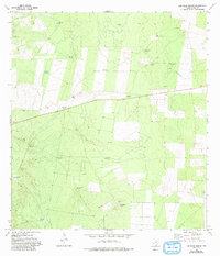
1972 Map of Las Islas Ranch
USGS Topo · Published 1993About this map
Las Islas Ranch anchors this portion of Starr County, where the landscape is defined by the vital infrastructure of cattle ranching and early resource exploration. The map reveals a sophisticated network of water sources, from the La Purisma Windmill in the south to the Brazil Windmill in the north, essential for sustaining life in this arid brush country. The distribution of these windmills, often carrying Spanish names like Cinca de Mayo Windmill and San Juan Windmill, reflects the deep cultural roots of the South Texas ranching tradition.
Find a feature on this map
20 named features on this map. Tap any name to fly to it.
Don’t see what you’re looking for? This feature index may not catch every label — zoom into the map to look around manually.
Map Details
Editions of this 1972 Las Islas Ranch Map
2 editions found
Other maps of this area

1938 · El Sauz
USGS Topo · 1:62,500

1938 · Agua Nueva
USGS Topo · 1:62,500

1938 · Sal Colorada
USGS Topo · 1:62,500

1938 · Cuevitas
USGS Topo · 1:62,500

1949 · Mc Allen
USGS Topo · 1:250,000

1954 · McAllen
USGS Topo · 1:250,000

1957 · Mc Allen
USGS Topo · 1:250,000

1962 · McAllen
USGS Topo · 1:250,000

1972 · Cuevitas
USGS Topo · 1:24,000
1972 · Viboras
USGS Topo · 1:24,000