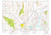
1954 Map of Las Vegas
USGS Topo · Published 1954About this map
Las Vegas and its neighbors North Las Vegas and Henderson appear at a pivotal moment of mid-century growth, bordered by the engineering feat of Hoover Dam. This landscape is defined by the massive federal presence of the Nellis Air Force Base and the Desert National Wildlife Range, alongside the recreational expansion at Lake Mead. The infrastructure of the era is evident in the Union Pacific rail lines connecting outposts like Arden and Dry Lake, and the presence of the Stardust International Raceway near the city center.
Find a feature on this map
108 named features on this map. Tap any name to fly to it.
Don’t see what you’re looking for? This feature index may not catch every label — zoom into the map to look around manually.
Map Details
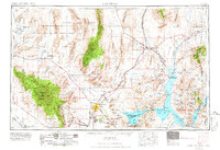
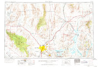
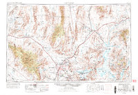
Editions of this 1954 Las Vegas Map
5 editions found

Other maps of this area

1885 · St. George
USGS Topo · 1:250,000

1885 · Pioche
USGS Topo · 1:250,000

1886 · Diamond Creek
USGS Topo · 1:250,000

1886 · Camp Mohave
USGS Topo · 1:250,000

1886 · Saint Thomas
USGS Topo · 1:250,000

1886 · Mt. Trumbull
USGS Topo · 1:250,000

1886 · Pioche
USGS Topo · 1:250,000

1891 · St. George
USGS Topo · 1:250,000

1892 · Diamond Creek
USGS Topo · 1:250,000

1892 · Mt. Trumbull
USGS Topo · 1:250,000