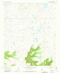
1963 Map of Las Vegas SE
USGS Topo · Published 1981About this map
The LAS VEGAS landscape south of the city center reveals a ranching economy defined by scattered homesteads and topographical challenges in the early 1960s. Family-named outposts like the Lewis Ranch, Spurlock Ranch, and Belden Ranch are situated among a complex network of small lakes and depressions on the plains. To the south, the terrain drops dramatically into the Cañon del Agua, where the Cañon del Agua Springs provided a vital water source for livestock and residents in this arid San Miguel County environment.
Find a feature on this map
13 named features on this map. Tap any name to fly to it.
Don’t see what you’re looking for? This feature index may not catch every label — zoom into the map to look around manually.
Map Details
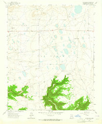
Editions of this 1963 Las Vegas SE Map
2 editions found
Other maps of this area

1889 · Las Vegas
USGS Topo · 1:125,000

1890 · Bernal
USGS Topo · 1:125,000

1891 · Bernal
USGS Topo · 1:125,000

1891 · Las Vegas
USGS Topo · 1:125,000

1892 · Watrous
USGS Topo · 1:125,000

1892 · Corazon
USGS Topo · 1:125,000

1893 · Las Vegas
USGS Topo · 1:125,000

1894 · Corazon
USGS Topo · 1:125,000

1894 · Watrous
USGS Topo · 1:125,000

1894 · Bernal
USGS Topo · 1:125,000