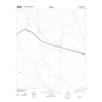
2013 Map of Lasca
USGS Topo · Published 2013About this map
Etholen and Lasca represent small, isolated settlements in the high desert of Hudspeth County, where transportation and water management dictate the landscape. The geography is defined by the northern reaches of the Quitman Mountains and a series of vital water catchments including Etholen Tank, Deer Tank, and Choke Tank. These features suggest a ranching economy that relies on carefully managed runoff in an arid environment. The road network connects remote outposts like Love Ranch via gravel and dirt tracks such as Love Rd and Lasca Branch Rd. Parallel to these local routes, the modern interstate corridor carves a straight path across the desert floor, reflecting the historical shift from localized rail and ranching traffic to high-speed transit. Notable drainage features like Lasca Br emphasize the rugged hydrological patterns that shape movement through this part of West Texas.
Find a feature on this map
18 named features on this map. Tap any name to fly to it.
Don’t see what you’re looking for? This feature index may not catch every label — zoom into the map to look around manually.
Map Details
Editions of this 2013 Lasca Map
This is the sole edition of this map. No revisions or reprints were ever made.
Other maps of this area

1894 · Fort Hancock
USGS Topo · 1:125,000

1895 · Sierra Blanca
USGS Topo · 1:125,000

1943 · Fort Quitman
USGS Topo · 1:62,500

1943 · Finlay Mountains
USGS Topo · 1:62,500

1948 · Triple Hill
USGS Topo · 1:62,500

1954 · Van Horn
USGS Topo · 1:250,000

1958 · Van Horn
USGS Topo · 1:250,000

1964 · Devil Ridge
USGS Topo · 1:24,000

1964 · Lasca
USGS Topo · 1:24,000

1964 · Sierra Blanca SW
USGS Topo · 1:24,000