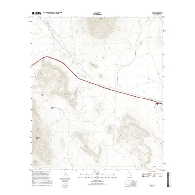
2016 Map of Lasca
USGS Topo · Published 2016About this map
Sierra Blanca dominates the northern horizon of this Trans-Pecos landscape, where the high desert meets the northern reaches of the Quitman Mountains. The settlement of Lasca is positioned along the primary transit corridor, defined by the modern Access Rd and several historic routes like Lasca Rd and The Boulevard. This arid environment is marked by an extensive system of water management features essential for ranching and survival, including Etholen Tank, Granger Tank, and Deer Tank. The topography is sharply defined by drainages and natural landmarks such as Red Light Draw and the steep walls of Skunk Canyon. In the southern portion of the map, the terrain descends into Silver King Canyon, illustrating the complex geological transition between the mountain ranges and the surrounding basins. The network of unimproved roads like Cowser Rd and Dunham Rd suggests a landscape shaped by long-standing agricultural and range land use.
Find a feature on this map
22 named features on this map. Tap any name to fly to it.
Don’t see what you’re looking for? This feature index may not catch every label — zoom into the map to look around manually.
Map Details
Editions of this 2016 Lasca Map
This is the sole edition of this map. No revisions or reprints were ever made.
Other maps of this area

1894 · Fort Hancock
USGS Topo · 1:125,000

1895 · Sierra Blanca
USGS Topo · 1:125,000

1943 · Fort Quitman
USGS Topo · 1:62,500

1943 · Finlay Mountains
USGS Topo · 1:62,500

1948 · Triple Hill
USGS Topo · 1:62,500

1954 · Van Horn
USGS Topo · 1:250,000

1958 · Van Horn
USGS Topo · 1:250,000

1964 · Devil Ridge
USGS Topo · 1:24,000

1964 · Lasca
USGS Topo · 1:24,000

1964 · Sierra Blanca SW
USGS Topo · 1:24,000