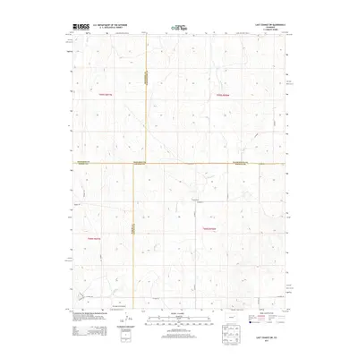
2013 Map of Last Chance SW
USGS Topo · Published 2013About this map
The Colorado High Plains intersect at a unique four-county junction on this 2013 survey, where Arapahoe, Washington, Elbert, and Lincoln counties meet. The landscape is defined by the ephemeral drainage patterns of Middlemist Cr and Beaver Cr, which carve subtle relief into the agricultural terrain. Human activity is sparse but distinct, centered on isolated holdings such as Brooks Ranch. In the southern portion of the map, a specialized infrastructure point appears at the Metrogro Farm Airport, served by a network of local thoroughfares including Runway Rd and Wardel Rd. This map captures the remote character of eastern Colorado, where section-line roads like Co Road 4D and Co Road 21 provide the primary framework for movement across the expansive range.
Find a feature on this map
27 named features on this map. Tap any name to fly to it.
Don’t see what you’re looking for? This feature index may not catch every label — zoom into the map to look around manually.
Map Details
Editions of this 2013 Last Chance SW Map
This is the sole edition of this map. No revisions or reprints were ever made.
Other maps of this area

1891 · Limon
USGS Topo · 1:125,000

1892 · Limon
USGS Topo · 1:125,000

1954 · Limon
USGS Topo · 1:250,000

1957 · Limon
USGS Topo · 1:250,000

1958 · Limon
USGS Topo · 1:250,000
1970 · Barking Dog Spring
USGS Topo · 1:24,000

1970 · T Draw
USGS Topo · 1:24,000

1973 · Last Chance SW
USGS Topo · 1:24,000
1973 · Cottonwood Valley South
USGS Topo · 1:24,000

1973 · Last Chance NW
USGS Topo · 1:24,000