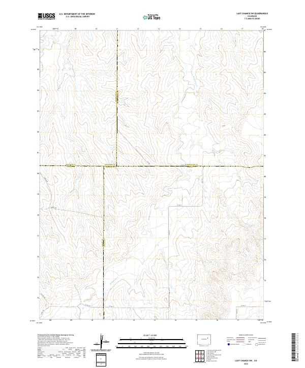
2022 Map of Last Chance SW
USGS Topo · Published 2022About this map
Middlemist Cr and Beaver Cr drain this high plains landscape at the convergence of four Colorado counties. The terrain is marked by the meeting of Arapahoe, Washington, Elbert, and Lincoln boundaries, creating a unique geographic corner where land survey lines and county borders intersect. The area maintains a rural, open character defined by a grid of county roads such as Co Rd D and Co Rd 3Z that follow the section lines of the Public Land Survey System. A small landing strip, indicated by Runway Rd, suggests the logistical needs of remote ranching or agricultural operations in this part of Lincoln County. The map provides a clear look at the drainage patterns and township divisions, including t5s r57w and t6s r56w, which are essential for tracing property ownership and land use history in the region.
Find a feature on this map
23 named features on this map. Tap any name to fly to it.
Don’t see what you’re looking for? This feature index may not catch every label — zoom into the map to look around manually.
Map Details
Editions of this 2022 Last Chance SW Map
This is the sole edition of this map. No revisions or reprints were ever made.
Other maps of this area

1891 · Limon
USGS Topo · 1:125,000

1892 · Limon
USGS Topo · 1:125,000

1954 · Limon
USGS Topo · 1:250,000

1957 · Limon
USGS Topo · 1:250,000

1958 · Limon
USGS Topo · 1:250,000
1970 · Barking Dog Spring
USGS Topo · 1:24,000

1970 · T Draw
USGS Topo · 1:24,000

1973 · Last Chance SW
USGS Topo · 1:24,000
1973 · Cottonwood Valley South
USGS Topo · 1:24,000

1973 · Last Chance NW
USGS Topo · 1:24,000