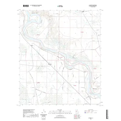
2020 Map of Latanier
USGS Topo · Published 2020About this map
The Red River snakes through this Louisiana landscape, defining the character of Rapides Parish with its sweeping oxbows and dense network of bayous. Near Miller Bluff, the river's path has left behind complex water features like Elbow Lake and Tarkill Lake, illustrating the dynamic nature of this alluvial plain. Small communities and family landmarks are scattered throughout the lowlands, including Latanier, Whittington, and Poland. Genealogists will find several notable burial sites such as Peart Cem, Wise Cem, and Mount Pleasant Cem situated near the riverbanks and along the local road network. The map reveals a land shaped by water and transport, with Bayou Latanier and Indian Bayou draining the wetlands between the river and the higher ground marked by Miller Bluff. This area's transition from riverfront settlements to inland bayous reflects a long history of agricultural and riparian life.
Find a feature on this map
63 named features on this map. Tap any name to fly to it.
Don’t see what you’re looking for? This feature index may not catch every label — zoom into the map to look around manually.
Map Details
Editions of this 2020 Latanier Map
This is the sole edition of this map. No revisions or reprints were ever made.
Other maps of this area

1935 · Lecompte
USGS Topo · 1:62,500

1940 · Marksville
USGS Topo · 1:62,500

1941 · Alexandria
USGS Topo · 1:62,500

1941 · Buckeye
USGS Topo · 1:62,500

1953 · Alexandria
USGS Topo · 1:250,000

1955 · Alexandria
USGS Topo · 1:250,000

1957 · Alexandria
USGS Topo · 1:62,500
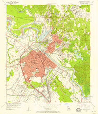
1957 · Alexandria
USGS Topo · 1:24,000

1957 · Lecompte
USGS Topo · 1:62,500

1959 · Buckeye
USGS Topo · 1:62,500