
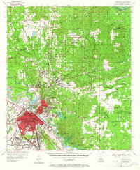
1957 Map of Alexandria
USGS Topo · Published 1958About this map
Alexandria and Pineville sit at the center of this 1957 survey, where the Red River separates the dense urban grid of the Rapides Parish seat from its sister city to the northeast. The map reveals an area defined by significant institutional and military footprints, including the sprawling Camp Beauregard and the extensive grounds of the Central Louisiana State Hospital. Beyond the city limits, the terrain transitions into the heavily wooded Kisatchie National Forest, which dominates the northern portion of the quadrangle.
Find a feature on this map
102 named features on this map. Tap any name to fly to it.
Don’t see what you’re looking for? This feature index may not catch every label — zoom into the map to look around manually.
Map Details
Editions of this 1957 Alexandria Map
2 editions found
Other maps of this area

1932 · Boyce NE
USGS Topo · 1:31,680

1932 · Colfax SE
USGS Topo · 1:31,680

1935 · Lecompte
USGS Topo · 1:62,500

1936 · Colfax
USGS Topo · 1:62,500

1936 · Pollock
USGS Topo · 1:62,500

1940 · Marksville
USGS Topo · 1:62,500

1941 · Jena
USGS Topo · 1:62,500

1941 · Alexandria
USGS Topo · 1:62,500

1941 · Buckeye
USGS Topo · 1:62,500

1941 · Pollock
USGS Topo · 1:62,500