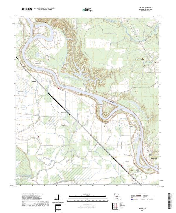
2024 Map of Latanier
USGS Topo · Published 2024About this map
Red River meanders through this portion of Rapides Parish, defining a landscape of complex hydrology and small agricultural settlements. The eastern bank is characterized by the community of Poland and the sites of Harris Ferry and Wilsons Ferry, indicating a history of river crossings before the establishment of modern bridges. On the western side of the river, the settlements of Latanier and Whittington are situated amidst a dense network of bayous and lakes, including Bayou Latanier, Elbow Lake, and Tiger Lake.
Find a feature on this map
70 named features on this map. Tap any name to fly to it.
Don’t see what you’re looking for? This feature index may not catch every label — zoom into the map to look around manually.
Map Details
Editions of this 2024 Latanier Map
This is the sole edition of this map. No revisions or reprints were ever made.
Other maps of this area

1935 · Lecompte
USGS Topo · 1:62,500

1940 · Marksville
USGS Topo · 1:62,500

1941 · Alexandria
USGS Topo · 1:62,500

1941 · Buckeye
USGS Topo · 1:62,500

1953 · Alexandria
USGS Topo · 1:250,000

1955 · Alexandria
USGS Topo · 1:250,000

1957 · Alexandria
USGS Topo · 1:62,500
1957 · Alexandria
USGS Topo · 1:24,000

1957 · Lecompte
USGS Topo · 1:62,500

1959 · Buckeye
USGS Topo · 1:62,500