
1964 Map of Latham
USGS Topo · Published 1965About this map
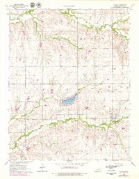
Latham serves as the primary settlement on this mid-1960s survey of southeastern Butler County, situated along the St. Louis San Francisco railroad line. The landscape is defined by the drainage basins of Hickory Creek and Rock Creek, which cut through the townships of Logan, Hickory, Clay, and Union. A central landmark is the Butler County State Lake, also identified as Clymer Lake, which represents a significant water management and recreational feature for the era. Genealogists will find several burial sites preserved here, including Latham Cem, Bryant Cem, and Brownlow Cem. The presence of a Landing Field and a Gravel Pit indicates the local infrastructure and industry supporting this rural Kansas community during the early 1960s.
Find a feature on this map
18 named features on this map. Tap any name to fly to it.
Don’t see what you’re looking for? This feature index may not catch every label — zoom into the map to look around manually.
Map Details
Editions of this 1964 Latham Map
2 editions found
Other maps of this area

1888 · Eldorado
USGS Topo · 1:125,000

1889 · Burden
USGS Topo · 1:125,000

1955 · Wichita
USGS Topo · 1:250,000

1958 · Wichita
USGS Topo · 1:250,000

1963 · Leon
USGS Topo · 1:24,000

1964 · Augusta SE
USGS Topo · 1:24,000

1964 · Beaumont
USGS Topo · 1:24,000

1964 · Cambridge NW
USGS Topo · 1:24,000
1964 · Keighley
USGS Topo · 1:24,000
1964 · Cambridge NE
USGS Topo · 1:24,000