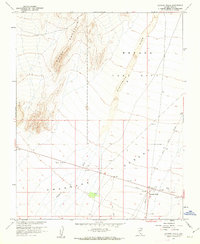
1961 Map of Lathrop Wells
USGS Topo · Published 1962About this map
The Amargosa Desert landscape during the early 1960s is defined here by the intersection of arid natural features and significant government activity. The small settlement of Lathrop Wells sits at a critical junction of routes, including 95 and 29, serving as a gateway for the surrounding region. The proximity of the Nevada Test Site to the northeast highlights the era's focus on nuclear research, a detail underscored by the mapping collaboration with the Atomic Energy Commission. Beyond the roads, the terrain is dominated by the prominent ridge of Yucca Mountain and the broad, dry expanse of Fortymile Wash. This survey details the utilitarian infrastructure of the period, from a localized Airstrip to scattered prospects and gravel pits, reflecting both the transportation needs and the small-scale mineral exploration of southern Nye County.
Find a feature on this map
16 named features on this map. Tap any name to fly to it.
Don’t see what you’re looking for? This feature index may not catch every label — zoom into the map to look around manually.
Map Details
Editions of this 1961 Lathrop Wells Map
3 editions found
Other maps of this area

1908 · Furnace Creek
USGS Topo · 1:250,000

1910 · Furnace Creek
USGS Topo · 1:250,000

1942 · Skull Mountain
USGS Topo · 1:125,000

1942 · Bullfrog
USGS Topo · 1:125,000

1948 · Death Valley
USGS Topo · 1:250,000

1952 · Topopah Spring
USGS Topo · 1:62,500

1952 · Big Dune
USGS Topo · 1:62,500

1954 · Bare Mtn
USGS Topo · 1:62,500

1954 · Death Valley
USGS Topo · 1:250,000

1956 · Death Valley
USGS Topo · 1:250,000