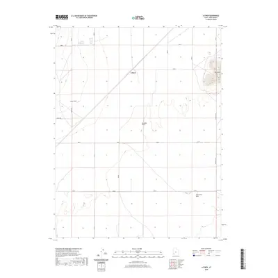
2020 Map of Latimer
USGS Topo · Published 2020About this map
The high arid basin of the Escalante Desert dominates this southwestern Utah landscape, where sparse settlements and natural landmarks define the high-desert character of Iron County. The small community of Latimer serves as a central point of reference, situated within an environment of wide alluvial plains and low-profile drainage patterns. The topography transitions from the open expanse of Lund Flats toward localized elevations like Blue Knoll in the east.
Find a feature on this map
9 named features on this map. Tap any name to fly to it.
Don’t see what you’re looking for? This feature index may not catch every label — zoom into the map to look around manually.
Map Details
Editions of this 2020 Latimer Map
This is the sole edition of this map. No revisions or reprints were ever made.
Other maps of this area

1885 · St. George
USGS Topo · 1:250,000

1891 · St. George
USGS Topo · 1:250,000

1950 · Enoch
USGS Topo · 1:62,500

1951 · Avon
USGS Topo · 1:24,000

1951 · Avon NW
USGS Topo · 1:24,000
1952 · Enoch NW
USGS Topo · 1:24,000

1953 · Richfield
USGS Topo · 1:250,000

1953 · Cedar City
USGS Topo · 1:250,000

1958 · Richfield
USGS Topo · 1:250,000

1958 · Cedar City
USGS Topo · 1:250,000