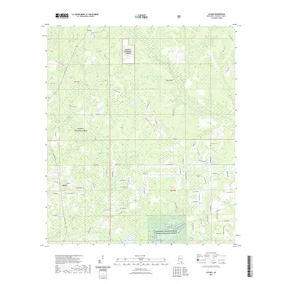
2021 Map of Latimer
USGS Topo · Published 2021About this map
De Soto National Forest covers a significant portion of this Jackson County landscape, where the coastal piney woods meet the intricate drainages of the Gulf Coast watershed. The settlement of Latimer serves as a local hub, connected by historical routes such as Old Biloxi Rd and Larue Rd to the community of Larue in the north. This modern survey reflects a region where conservation and rural development coexist, evidenced by the southern border with the Mississippi Sandhill Crane National Wildlife Refuge. Numerous family-named landmarks and historical sites are preserved here, including the Wilkerson Cem and Seymour Cem. The area is defined by its water, with Bluff Creek and Bayou Costapia carving through the terrain, illustrating the low-lying, riparian character of Mississippi’s coastal plain just inland from the sound.
Find a feature on this map
77 named features on this map. Tap any name to fly to it.
Don’t see what you’re looking for? This feature index may not catch every label — zoom into the map to look around manually.
Map Details
Editions of this 2021 Latimer Map
This is the sole edition of this map. No revisions or reprints were ever made.
Other maps of this area

1941 · Vancleave
USGS Topo · 1:62,500

1943 · Pascagoula
USGS Topo · 1:62,500

1943 · Vancleave
USGS Topo · 1:62,500

1944 · Vancleave
USGS Topo · 1:62,500

1953 · Mobile
USGS Topo · 1:250,000

1954 · Vestry
USGS Topo · 1:62,500

1954 · Ocean Springs
USGS Topo · 1:24,000

1954 · Biloxi
USGS Topo · 1:24,000

1954 · Biloxi
USGS Topo · 1:62,500

1955 · Pascagoula
USGS Topo · 1:62,500