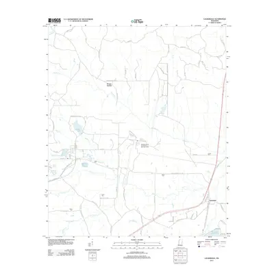
2012 Map of Lauderdale
USGS Topo · Published 2012About this map
Kemper Springs and the village of Lauderdale anchor this eastern Mississippi landscape, defined largely by the expansive military footprint of the Meridian Naval Air Station (Mc Cain Field). The geography is a complex network of small creek drainages, including Ponta Cr and Big Reed Cr, which feed into numerous localized impoundments such as Martha Lake, Helen Lake, and McElroys Lake. These water features, alongside larger bodies like Dalewood Shore Lake, illustrate the region's managed hydrology and its role in local recreation and drainage.
Find a feature on this map
80 named features on this map. Tap any name to fly to it.
Don’t see what you’re looking for? This feature index may not catch every label — zoom into the map to look around manually.
Map Details
Editions of this 2012 Lauderdale Map
This is the sole edition of this map. No revisions or reprints were ever made.
Other maps of this area

1921 · Meridian
USGS Topo · 1:48,000

1923 · Meridian
USGS Topo · 1:62,500

1953 · Meridian
USGS Topo · 1:250,000

1957 · Meridian
USGS Topo · 1:250,000

1962 · Daleville
USGS Topo · 1:24,000

1962 · Lauderdale
USGS Topo · 1:24,000

1962 · Lauderdale NW
USGS Topo · 1:24,000

1962 · Oak Grove
USGS Topo · 1:24,000

1965 · Meridian
USGS Topo · 1:250,000

1971 · Meridian North
USGS Topo · 1:24,000