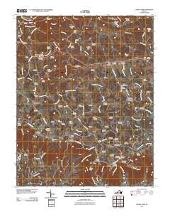
2010 Map of Laurel Fork
USGS Topo · Published 2010About this map
Groundhog Mountain rises prominently above the complex drainage networks of Carroll County, where the Blue Ridge escarpment transitions into a landscape defined by deeply etched creek valleys and high knobs. This area is characterized by a dense concentration of family burial grounds and small communities such as Nester, Gladesboro, and Crooked Oak, reflecting a history of decentralized highland settlement. The presence of the Blue Ridge Pkwy winding through the south near Orchard Gap introduces a modern recreational layer over the older rural infrastructure, providing access to landmarks like the Pilot Mountain Overlook.
Find a feature on this map
121 named features on this map. Tap any name to fly to it.
Don’t see what you’re looking for? This feature index may not catch every label — zoom into the map to look around manually.
Map Details
Editions of this 2010 Laurel Fork Map
This is the sole edition of this map. No revisions or reprints were ever made.
Other maps of this area

1889 · Hillsville
USGS Topo · 1:125,000

1892 · Hillsville
USGS Topo · 1:125,000

1896 · Hillsville
USGS Topo · 1:125,000

1928 · Stuart
USGS Topo · 1:48,000

1931 · Stuart
USGS Topo · 1:62,500

1953 · Winston-Salem
USGS Topo · 1:250,000

1955 · Winston-Salem
USGS Topo · 1:250,000

1956 · Macks Mountain
USGS Topo · 1:62,500

1957 · Mount Airy
USGS Topo · 1:62,500

1957 · Floyd
USGS Topo · 1:62,500