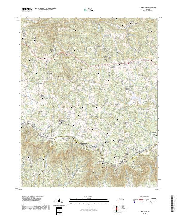
2022 Map of Laurel Fork
USGS Topo · Published 2022About this map
Carroll and Patrick counties meet along a landscape defined by the winding course of the Blue Ridge Parkway, which meanders through this section of the Blue Ridge Mountains. This 2022 survey documents a rural environment where family history is deeply rooted, evidenced by the high density of small burial grounds such as the Shadrick Worrell Cem, Henry Floyd Vass Cem, and the McGrady-Thomas Cem. The area is characterized by several spiritual anchors, including the Laurel Fork Primitive Baptist Church and Gladesboro Lutheran Church, which serve the scattered residential communities. Waterways like Big Reed Island Creek and Laurel Fork carve through the terrain, while specialized transportation is represented by small airstrips like Wemmering Airport and Groundhog Mountain Airport. The map also captures several family-named landmarks and historical homestead identifiers, such as the Eli Sowers Cem and John Cassell Cem, offering a detailed view of the regional lineage.
Find a feature on this map
177 named features on this map. Tap any name to fly to it.
Don’t see what you’re looking for? This feature index may not catch every label — zoom into the map to look around manually.
Map Details
Editions of this 2022 Laurel Fork Map
This is the sole edition of this map. No revisions or reprints were ever made.
Other maps of this area

1889 · Hillsville
USGS Topo · 1:125,000

1892 · Hillsville
USGS Topo · 1:125,000

1896 · Hillsville
USGS Topo · 1:125,000

1928 · Stuart
USGS Topo · 1:48,000

1931 · Stuart
USGS Topo · 1:62,500

1953 · Winston-Salem
USGS Topo · 1:250,000

1955 · Winston-Salem
USGS Topo · 1:250,000

1956 · Macks Mountain
USGS Topo · 1:62,500

1957 · Mount Airy
USGS Topo · 1:62,500

1957 · Floyd
USGS Topo · 1:62,500