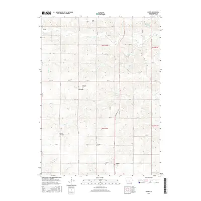
2015 Map of Laurel
USGS Topo · Published 2015About this map
Laurel and Haverhill anchor this Marshall County landscape, characterized by a dense network of sectional roads and small rural cemeteries. The area is defined by the drainage patterns of Middle Timber Cr and S Timber Cr, which wind through the township boundaries of T82N and T83N. Genealogists will find significant value in the distribution of family and denominational burial grounds, such as the Immaculate Conception Cem near Haverhill and the Saint-John's United Church of Christ Cem to the south.
Find a feature on this map
55 named features on this map. Tap any name to fly to it.
Don’t see what you’re looking for? This feature index may not catch every label — zoom into the map to look around manually.
Map Details
Editions of this 2015 Laurel Map
This is the sole edition of this map. No revisions or reprints were ever made.
Other maps of this area

1954 · Waterloo
USGS Topo · 1:250,000

1954 · Des Moines
USGS Topo · 1:250,000

1955 · Waterloo
USGS Topo · 1:250,000

1956 · Des Moines
USGS Topo · 1:250,000

1957 · Des Moines
USGS Topo · 1:250,000

1960 · Marshalltown
USGS Topo · 1:24,000

1960 · Marshalltown
USGS Topo · 1:62,500

1960 · Le Grand
USGS Topo · 1:24,000

1969 · Des Moines
USGS Topo · 1:250,000
1975 · Melbourne
USGS Topo · 1:24,000