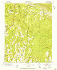
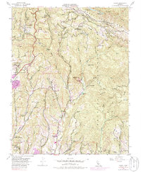
1955 Map of Laurel
USGS Topo · Published 1956About this map
The San Andreas Rift Zone cuts a distinct path through the Santa Cruz Mts in this mid-century survey, defining the complex landscape of the Soquel Augmentation. The map captures a period of transition for several mountain communities, documenting the infrastructure of settlements like Laurel, Glenwood, and Skyland. Local transport and industry are anchored by the winding Old San Jose Road and the remnants of the Southern Pacific RR (Abandoned), which once served the timber and agricultural needs of the region.
Find a feature on this map
72 named features on this map. Tap any name to fly to it.
Don’t see what you’re looking for? This feature index may not catch every label — zoom into the map to look around manually.
Map Details
Editions of this 1955 Laurel Map
7 editions found
Other maps of this area

1902 · Santa Cruz
USGS Topo · 1:125,000

1912 · Capitola
USGS Topo · 1:62,500

1914 · Capitola
USGS Topo · 1:62,500

1916 · New Almaden
USGS Topo · 1:48,000

1919 · New Almaden
USGS Topo · 1:62,500

1940 · Capitola
USGS Topo · 1:62,500

1940 · Los Gatos
USGS Topo · 1:62,500

1943 · Los Gatos
USGS Topo · 1:62,500

1947 · San Francisco
USGS Topo · 1:250,000

1947 · San Jose
USGS Topo · 1:250,000