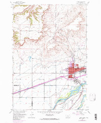
1956 Map of Laurel
USGS Topo · Published 1970About this map
The city of Laurel sits at a critical junction of river-valley agriculture and heavy industry, as shown in this mid-century survey updated with late-1960s urban expansions. The landscape is defined by the convergence of the Yellowstone River and the Clarks Fork Yellowstone River, which support an intricate network of irrigation including the Big Ditch, Cove Ditch, and White Horse Canal.
Find a feature on this map
41 named features on this map. Tap any name to fly to it.
Don’t see what you’re looking for? This feature index may not catch every label — zoom into the map to look around manually.
Map Details
Editions of this 1956 Laurel Map
2 editions found
Other maps of this area

1954 · Billings
USGS Topo · 1:250,000

1956 · Molt
USGS Topo · 1:24,000

1956 · Rimrock
USGS Topo · 1:24,000

1956 · Silesia
USGS Topo · 1:24,000

1956 · Two Pine School
USGS Topo · 1:24,000

1956 · Laurel
USGS Topo · 1:24,000

1956 · Park City
USGS Topo · 1:24,000
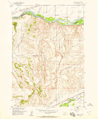
1956 · Montaqua
USGS Topo · 1:24,000

1956 · Mossmain
USGS Topo · 1:24,000

1957 · Billings
USGS Topo · 1:250,000