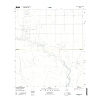
2016 Map of Laureles Ranch
USGS Topo · Published 2016About this map
Petronila Creek meanders through the coastal prairie of the South Texas brush country, defining the landscape of the Nueces Co and Kleberg Co border. This survey captures a region dominated by large-scale agricultural operations and legacy ranching interests, most notably the namesake Laureles Ranch located near the eastern edge of the quadrangle. The drainage patterns are clearly defined by the winding course of Chiltipin Cr and the presence of Chapman Ranch Lake, which serve as vital water resources in this semi-arid environment. A rigid grid of rural routes, including Salas Ranch Rd and Fm 70, bisects the expansive fields, illustrating the organized land division typical of the area's mid-20th-century development. The map provides a precise look at the intersection of natural riparian corridors and the industrial-scale farming infrastructure that characterizes this portion of the Texas coastline.
Find a feature on this map
24 named features on this map. Tap any name to fly to it.
Don’t see what you’re looking for? This feature index may not catch every label — zoom into the map to look around manually.
Map Details
Editions of this 2016 Laureles Ranch Map
This is the sole edition of this map. No revisions or reprints were ever made.
Other maps of this area

1924 · Petronilla
USGS Topo · 1:62,500

1925 · Oso Creek
USGS Topo · 1:62,500

1928 · Sarita
USGS Topo · 1:125,000

1950 · Corpus Christi
USGS Topo · 1:250,000

1951 · South Bird Island NW
USGS Topo · 1:24,000

1951 · Oso Creek NW
USGS Topo · 1:24,000

1951 · Riviera Beach NE
USGS Topo · 1:24,000

1951 · Oso Creek
USGS Topo · 1:62,500

1951 · South Bird Island
USGS Topo · 1:62,500

1952 · Riviera Beach NW
USGS Topo · 1:24,000