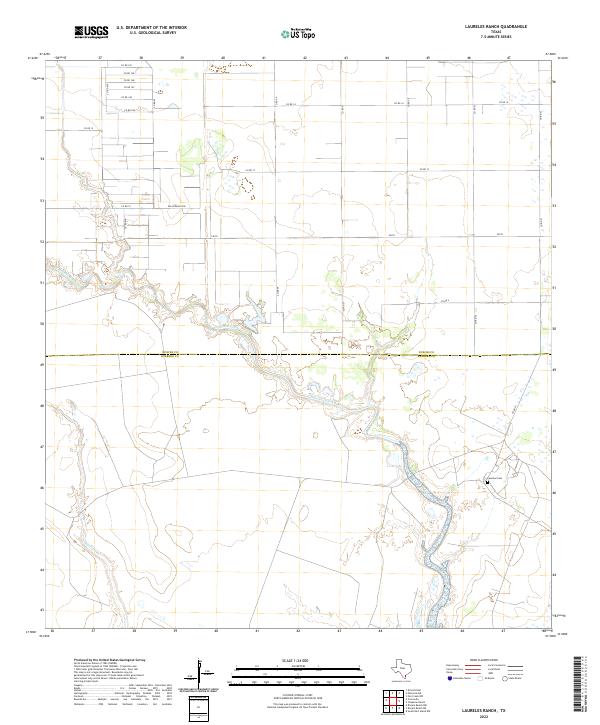
2022 Map of Laureles Ranch
USGS Topo · Published 2022About this map
Petronila Creek meanders across this South Texas coastal plain, defining much of the drainage and low-lying wetland character at the boundary of Nueces County and Kleberg County. The landscape is dominated by large-scale agricultural and ranching parcels, connected by an organized grid of county roads and more specialized routes like Salas Ranch Rd. In the southeastern corner, the presence of the Laureles Cem provides a specific point of genealogical interest within an otherwise open rural landscape. South of the main creek, Chiltipin Cr also cuts through the terrain, further illustrating the intricate natural hydrology of the region. The map shows the area as it exists today, with established transportation corridors such as FM 70 facilitating travel between these inland ranch lands and the nearby Gulf Coast interior.
Find a feature on this map
23 named features on this map. Tap any name to fly to it.
Don’t see what you’re looking for? This feature index may not catch every label — zoom into the map to look around manually.
Map Details
Editions of this 2022 Laureles Ranch Map
This is the sole edition of this map. No revisions or reprints were ever made.
Other maps of this area

1924 · Petronilla
USGS Topo · 1:62,500

1925 · Oso Creek
USGS Topo · 1:62,500

1928 · Sarita
USGS Topo · 1:125,000

1950 · Corpus Christi
USGS Topo · 1:250,000

1951 · South Bird Island NW
USGS Topo · 1:24,000

1951 · Oso Creek NW
USGS Topo · 1:24,000

1951 · Riviera Beach NE
USGS Topo · 1:24,000

1951 · Oso Creek
USGS Topo · 1:62,500

1951 · South Bird Island
USGS Topo · 1:62,500

1952 · Riviera Beach NW
USGS Topo · 1:24,000