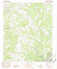
1983 Map of Laurens North
USGS Topo · Published 1983About this map
Laurens and its northern outskirts are captured here during the early 1980s, showcasing a landscape where traditional agricultural patterns and small settlements meet modern infrastructure. The Seaboard railroad corridor serves as a primary axis, connecting the larger hubs of Gray Court and Barksdale. This corridor is dotted with numerous rural spiritual and educational landmarks, including Rose of Sharon Ch and the Gray Court-Owings Sch, reflecting the community-centered layout of Laurens County.
Find a feature on this map
37 named features on this map. Tap any name to fly to it.
Don’t see what you’re looking for? This feature index may not catch every label — zoom into the map to look around manually.
Map Details
Editions of this 1983 Laurens North Map
This is the sole edition of this map. No revisions or reprints were ever made.
Other maps of this area

1892 · Abbeville
USGS Topo · 1:125,000

1941 · Spartanburg
USGS Topo · 1:250,000

1953 · Spartanburg
USGS Topo · 1:250,000

1954 · Greenville
USGS Topo · 1:250,000

1957 · Fountain Inn
USGS Topo · 1:62,500

1958 · Greenville
USGS Topo · 1:250,000

1960 · Spartanburg
USGS Topo · 1:250,000

1963 · Spartanburg
USGS Topo · 1:250,000

1964 · Spartanburg
USGS Topo · 1:250,000

1969 · Ora
USGS Topo · 1:24,000