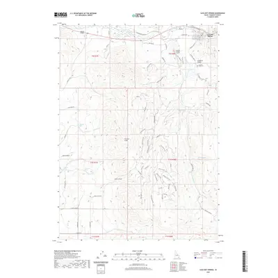
2020 Map of Lava Hot Springs
USGS Topo · Published 2020About this map
Lava Hot Springs occupies the northeastern corner of this landscape, situated along the Portneuf River where it winds past the Lava Hot Springs Airport. The terrain is defined by the high elevations of the Portneuf Range, which creates a complex network of drainages and canyons. Significant among these are Jenkins Canyon to the north and Smith Canyon further south. The map documents numerous water sources critical to this arid high-country environment, including Chatterton Spring, Christenson Spring, and Welcome Spring. Local history is anchored by the Lava Hot Springs Cem located near Henderson Canyon. Transportation routes follow the natural topography, with E Old Oregon Trail Rd and E Hwy 30 tracking the river valley, while secondary roads like Dempsey Creek Rd provide access into the more remote reaches of the range.
Find a feature on this map
74 named features on this map. Tap any name to fly to it.
Don’t see what you’re looking for? This feature index may not catch every label — zoom into the map to look around manually.
Map Details
Editions of this 2020 Lava Hot Springs Map
This is the sole edition of this map. No revisions or reprints were ever made.
Other maps of this area

1915 · Preston
USGS Topo · 1:96,000

1918 · Preston
USGS Topo · 1:125,000

1948 · Bancroft
USGS Topo · 1:62,500

1949 · Bancroft
USGS Topo · 1:62,500

1954 · Pocatello
USGS Topo · 1:250,000

1955 · Preston
USGS Topo · 1:250,000

1958 · Pocatello
USGS Topo · 1:250,000

1958 · Preston
USGS Topo · 1:250,000

1962 · Preston
USGS Topo · 1:250,000

1968 · Downey West
USGS Topo · 1:24,000