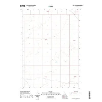
2020 Map of Lava Lake Reservoir
USGS Topo · Published 2020About this map
Lava Lake Reservoir and its surrounding water bodies define this remote stretch of the Upper Snake River Plain. This 2020 survey of southeastern Idaho focuses on a high-desert landscape shaped by seasonal hydrology and the infrastructure needed to manage it. The map traces the expanse of Wood Road Lake and Grover Lake Reservoir, which serve as vital water resources in a region dominated by sagebrush and volcanic features. Human presence is largely defined by the grid-like Public Land Survey System and the long thoroughfares that cut across the basin. The southern edge of the quadrangle is anchored by the Big Butte Springfield Rd, while Taber Rd skirts the northeastern boundary, providing the primary links for local ranching and agricultural transport across Bingham County.
Find a feature on this map
11 named features on this map. Tap any name to fly to it.
Don’t see what you’re looking for? This feature index may not catch every label — zoom into the map to look around manually.
Map Details
Editions of this 2020 Lava Lake Reservoir Map
This is the sole edition of this map. No revisions or reprints were ever made.
Other maps of this area

1955 · Springfield NW
USGS Topo · 1:24,000

1955 · Idaho Falls
USGS Topo · 1:250,000

1958 · Idaho Falls
USGS Topo · 1:250,000

1973 · Scoville
USGS Topo · 1:24,000

1973 · Middle Butte
USGS Topo · 1:24,000

1973 · Taber
USGS Topo · 1:24,000

1973 · Rock Butte
USGS Topo · 1:24,000

1973 · Atomic City
USGS Topo · 1:24,000

1973 · Lava Lake Reservoir
USGS Topo · 1:24,000

1973 · Coffee Point NE
USGS Topo · 1:24,000