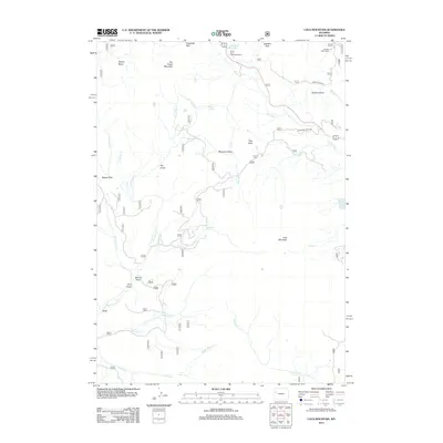
2012 Map of Lava Mountain
USGS Topo · Published 2012About this map
Togwotee Pass stands as a primary high-altitude corridor in this high-country survey of Wyoming's Absaroka and Wind River ranges. The landscape is defined by its dramatic drainage networks, with the Wind River and its upper tributaries like Deception Cr and Moccasin Cr carving through complex terrain. Settlement is sparse, focused on the established Brooks Lake Lodge and the Wind River Lake Picnic Area, reflecting the area's long-standing role as a recreational and transit gateway. The map meticulously documents the transition from peak to basin, notably at Sublette Peak and Lava Mountain. For researchers, the 2012 data shows the intricate forest road system including Moccasin Basin Rd and Brooks Lake Rd, alongside remote water bodies like Square Lake and Pelham Lake that remain central to the region's geography.
Find a feature on this map
35 named features on this map. Tap any name to fly to it.
Don’t see what you’re looking for? This feature index may not catch every label — zoom into the map to look around manually.
Map Details
Editions of this 2012 Lava Mountain Map
This is the sole edition of this map. No revisions or reprints were ever made.
Other maps of this area

1902 · Mt Leidy
USGS Topo · 1:125,000

1905 · Younts Peak
USGS Topo · 1:125,000

1907 · Younts Peak
USGS Topo · 1:125,000

1955 · Driggs
USGS Topo · 1:250,000

1955 · Thermopolis
USGS Topo · 1:250,000

1956 · Fish Lake
USGS Topo · 1:24,000

1956 · Kisinger Lakes
USGS Topo · 1:24,000
1956 · Dundee Meadows
USGS Topo · 1:24,000

1958 · Driggs
USGS Topo · 1:250,000

1958 · Thermopolis
USGS Topo · 1:250,000