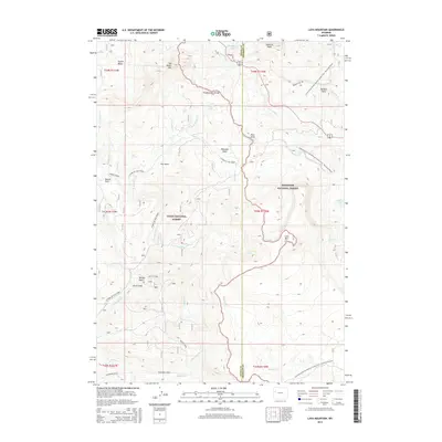
2015 Map of Lava Mountain
USGS Topo · Published 2015About this map
Lava Mtn and Sublette Peak define the high-elevation divide where the Teton National Forest meets the Shoshone National Forest. This 2015 survey illustrates a landscape dominated by the Continental Divide, which separates the headwaters of the Wind River from the westward-flowing drainages of N Fork Fish Cr. The terrain is marked by significant topographical landmarks such as Two Ocean Mtn, Pilot Knob, and the broad alpine meadows of Beauty Park.
Find a feature on this map
43 named features on this map. Tap any name to fly to it.
Don’t see what you’re looking for? This feature index may not catch every label — zoom into the map to look around manually.
Map Details
Editions of this 2015 Lava Mountain Map
This is the sole edition of this map. No revisions or reprints were ever made.
Other maps of this area

1902 · Mt Leidy
USGS Topo · 1:125,000

1905 · Younts Peak
USGS Topo · 1:125,000

1907 · Younts Peak
USGS Topo · 1:125,000

1955 · Driggs
USGS Topo · 1:250,000

1955 · Thermopolis
USGS Topo · 1:250,000

1956 · Fish Lake
USGS Topo · 1:24,000

1956 · Kisinger Lakes
USGS Topo · 1:24,000
1956 · Dundee Meadows
USGS Topo · 1:24,000

1958 · Driggs
USGS Topo · 1:250,000

1958 · Thermopolis
USGS Topo · 1:250,000