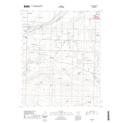
2020 Map of Lavaca
USGS Topo · Published 2020About this map
Lavaca serves as a central hub on this Sebastian County landscape, situated just south of the Ozark Lake reservoir on the Arkansas River. The terrain transitions from the low-lying river bottoms near Frastee Bend Cutoff into the more varied topography of Bloomer Ridge and Butlers Ridge to the south. Numerous small family and community burial sites are scattered throughout the quadrangle, including the Measles Memorial Cem in town and the remote William Teague Cem further south, providing a dense record of local genealogy.
Find a feature on this map
90 named features on this map. Tap any name to fly to it.
Don’t see what you’re looking for? This feature index may not catch every label — zoom into the map to look around manually.
Map Details
Editions of this 2020 Lavaca Map
This is the sole edition of this map. No revisions or reprints were ever made.
Other maps of this area

1879 · Fort Smith
USGS Topo · 1:62,500

1887 · Van Buren
USGS Topo · 1:62,500

1887 · Greenwood
USGS Topo · 1:62,500

1890 · Fort Smith
USGS Topo · 1:125,000

1906 · Lavaca
USGS Topo · 1:62,500

1906 · Barber
USGS Topo · 1:62,500

1943 · Fort Smith
USGS Topo · 1:125,000

1946 · Fort Smith
USGS Topo · 1:250,000
1946 · Charleston
USGS Topo · 1:24,000

1947 · Lavaca
USGS Topo · 1:62,500