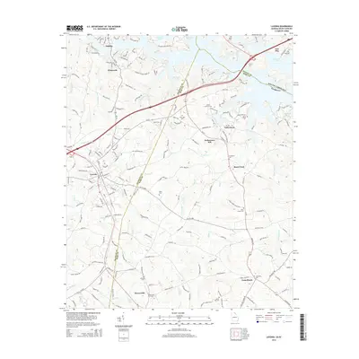
2014 Map of Lavonia
USGS Topo · Published 2014About this map
Lavonia and Bowersville anchor the landscape along the Franklin Co Hart Co line, illustrating the modern rural-urban interface in Northeast Georgia. The topography is defined by the winding fingers of Hartwell Lake, which reach into the northern reaches of the quadrangle near Gumlog and the South Carolina Georgia border. This area reflects a long history of local settlement and industry, evidenced by the central location of Parkertown Mill and numerous small-scale communities like Parkertown and Shoal Creek.
Find a feature on this map
174 named features on this map. Tap any name to fly to it.
Don’t see what you’re looking for? This feature index may not catch every label — zoom into the map to look around manually.
Map Details
Editions of this 2014 Lavonia Map
This is the sole edition of this map. No revisions or reprints were ever made.
Other maps of this area

1886 · Walhalla
USGS Topo · 1:125,000

1888 · Pickens
USGS Topo · 1:125,000

1891 · Carnesville
USGS Topo · 1:125,000

1892 · Walhalla
USGS Topo · 1:125,000

1893 · Elberton
USGS Topo · 1:125,000

1894 · Pickens
USGS Topo · 1:125,000

1896 · Walhalla
USGS Topo · 1:125,000

1954 · Greenville
USGS Topo · 1:250,000

1958 · Greenville
USGS Topo · 1:250,000

1958 · Fair Play
USGS Topo · 1:24,000