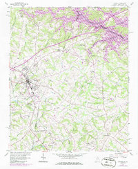
1985 Map of Lavonia
USGS Topo · Published 1986About this map
The Southern RR railroad corridor serves as the industrial spine for this Georgia-South Carolina borderlands region, anchoring the growth of Lavonia and nearby Bowersville. During this era of the mid-1980s, the landscape reflects a transition from traditional rural industry, exemplified by Parkertown Mill, to the recreational and hydrological impact of Hartwell Lake along the Tugaloo River. The map reveals a dense network of local community life through numerous rural congregations, including Willis Chapel, New Light Ch, and Shoal Creek Ch.
Find a feature on this map
38 named features on this map. Tap any name to fly to it.
Don’t see what you’re looking for? This feature index may not catch every label — zoom into the map to look around manually.
Map Details
Editions of this 1985 Lavonia Map
This is the sole edition of this map. No revisions or reprints were ever made.
Other maps of this area

1886 · Walhalla
USGS Topo · 1:125,000

1888 · Pickens
USGS Topo · 1:125,000

1891 · Carnesville
USGS Topo · 1:125,000

1892 · Walhalla
USGS Topo · 1:125,000

1893 · Elberton
USGS Topo · 1:125,000

1894 · Pickens
USGS Topo · 1:125,000

1896 · Walhalla
USGS Topo · 1:125,000

1954 · Greenville
USGS Topo · 1:250,000

1958 · Greenville
USGS Topo · 1:250,000

1958 · Fair Play
USGS Topo · 1:24,000