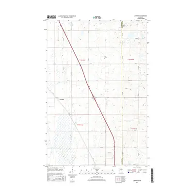
2016 Map of Lawndale
USGS Topo · Published 2016About this map
The settlement of Lawndale serves as the focal point for this landscape in the Red River Valley region, situated near the southwestern corner of the quadrangle. This area is characterized by a mix of agricultural plots and low-lying wetlands, most notably the expansive Lawndale Swamp and the channelized Judicial Ditch Number Three-Two. The map reveals the intricate rural road network that follows the Public Land Survey System grid, intersected diagonally by Co Hwy 52. Local history and genealogy are anchored by small, established burial grounds like Prairie View Cem and Little Bethany Cem, the latter situated near the border of Wilkin and Otter Tail Counties. The drainage of Deerhorn Cr meanders across the central township, illustrating the natural watercourses that persist amidst the heavily managed agricultural drainage systems of the Minnesota plains.
Find a feature on this map
44 named features on this map. Tap any name to fly to it.
Don’t see what you’re looking for? This feature index may not catch every label — zoom into the map to look around manually.
Map Details
Editions of this 2016 Lawndale Map
This is the sole edition of this map. No revisions or reprints were ever made.
Other maps of this area

1913 · Fergus Falls
USGS Topo · 1:62,500

1914 · Pelican Rapids
USGS Topo · 1:62,500

1917 · Pelican Rapids
USGS Topo · 1:62,500

1919 · Rothsay
USGS Topo · 1:62,500

1919 · Barnesville
USGS Topo · 1:62,500

1951 · Rothsay
USGS Topo · 1:62,500

1952 · Barnesville
USGS Topo · 1:62,500

1953 · Fargo
USGS Topo · 1:250,000

1956 · Fargo
USGS Topo · 1:250,000
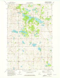
1973 · Lake Olaf
USGS Topo · 1:24,000