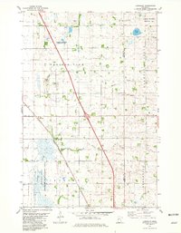
1981 Map of Lawndale
USGS Topo · Published 1981About this map
Lawndale sits at the intersection of a vast agricultural and conservation landscape along the Wilkin Co Otter Tail Co border. The settlement pattern here is defined by the Burlington Northern railroad corridor, which cuts diagonally across the prairie townships of Prairie View, Tanberg, and Norwegian Grove. Local history is anchored by the Little Bethany Ch and the Prairie View Cem, reflecting the enduring community structures of this Red River Valley region.
Find a feature on this map
18 named features on this map. Tap any name to fly to it.
Don’t see what you’re looking for? This feature index may not catch every label — zoom into the map to look around manually.
Map Details
Editions of this 1981 Lawndale Map
This is the sole edition of this map. No revisions or reprints were ever made.
Other maps of this area

1913 · Fergus Falls
USGS Topo · 1:62,500

1914 · Pelican Rapids
USGS Topo · 1:62,500

1917 · Pelican Rapids
USGS Topo · 1:62,500

1919 · Rothsay
USGS Topo · 1:62,500

1919 · Barnesville
USGS Topo · 1:62,500

1951 · Rothsay
USGS Topo · 1:62,500

1952 · Barnesville
USGS Topo · 1:62,500

1953 · Fargo
USGS Topo · 1:250,000

1956 · Fargo
USGS Topo · 1:250,000
1973 · Lake Olaf
USGS Topo · 1:24,000